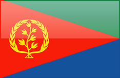
Country fact sheet: Eritrea


The ci:grasp country factsheets provide country based information compiled from various sources, including Worldbank, CIA World Factbook and FAO Stat.
Information covers general country information, GDP (Gross domestic product), land use and water use.

| A | B | C | D | E | F | G | H | I | J | K | L | M | N | O | P | Q | R | S | T | U | V | W | X | Y | Z |


General country information

Country sizetotal: 117,600 sq kmSource: CIA World Factbook
Population size6,233,682 (July 2013 est.)Source: CIA World Factbook
Coastline2,234 km (mainland on Red Sea 1,151 km, islands in Red Sea 1,083 kmSource: CIA World Factbook
Type of governmenttransitional governmentSource: CIA World Factbook
Administrative units (level1)6 regionsSource: CIA World Factbook
Life expectancy at birth62.86 yearsSource: CIA World Factbook
Child mortality68Source: Worldbank SH.DYN.MORT
Literacy rate (male)78.7%Source: CIA World Factbook
Literacy rate (female)57.5% (2010 est.)Source: CIA World Factbook

GDP (Gross domestic product)

Total GDP per capita$800 (2012 est.)Source: CIA World Factbook
GDP (agriculture)11.6%Source: CIA World Factbook
GDP (industry)30.6%Source: CIA World Factbook
GDP (services)57.8% (2012 est.)Source: CIA World Factbook

Ecological information

Carbondioxide798,200 Mt (2010 est.)Source: CIA World Factbook

Land use

Total area (ha)1.2e+07Source: (FAO Stat)
Area Agriculture (%)65Source: (FAO Stat)
Arable Area (%)5.9Source: (FAO Stat)
Irrigated Area (%)0.18Source: (FAO Stat)
Forest Area (%)13Source: (FAO Stat)

Water use

Total annual freshwater withdrawal (km³)0.58Source: (Worldbank ER.H2O.FWTL.K3)
Freshwater withdrawal for agriculture(%)94Source: (Worldbank ER.H2O.FWAG.ZS)
Freshwater withdrawal for industry(%)0.17Source: (Worldbank ER.H2O.FWIN.ZS)
Freshwater withdrawal for domestic use(%)5.3Source: (Worldbank ER.H2O.FWDM.ZS)