Example: ISI-MIP Impact Map Explorer
Screenshot detail |
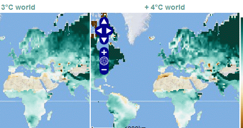
The ISI-MIP Impact Map Explorer allows to flexibly explore impact maps from the Inter-Sectoral Impact Model Intercomparison Project ISI-MIP. The user can, e.g., compare impact model results (relative changes) for different time steps, GCMs, emission scenarios or temperature increase scenarios.
The ISI-MIP Impact Map Explorer dynamically provides sets of coupled interactive maps to facilitate co-ordinated zooming and anning.
Available as part of the impact module of the Climate Impacts: Global and Regional Adaptation Support Platform (ci:grasp).
Examples
Information systems
Tailored interactive components
|
|